
|
| Earthquake Observation Center |
The Earthquake Observation Center was established in accordance with the reorganization of the Earthquake Research Institute in 1994 by integrating those observatories, divisions and centers that deal with direct observations. The center is composed of four observational research groups: inland and offshore earthquakes, crustal movement, and strong ground motion. The center also administers ten observatories: five seismic and five crustal movement observatories. By conducting both telemetry and mobile onshore-offshore observations for clarifying details of processes and mechanisms of earthquake generation, such projects as "A New Observational Research Project for Earthquake Predictions" and other earthquake-research-related tasks commissioned by MEXT (Ministry of Education, Culture, Sports, Science and Technology) have been promoted. New observational techniques such as satellite telemetry systems and ocean bottom observations have been developed as well.
Earthquake Research Group
・Monitoring of crustal activities using the earthquake observation telemetry network with ~100 stations
・Detailed understanding of crustal activities using dense arrays of mobile earthquake stations.
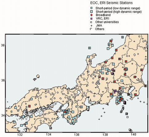
Map of the seismic stations of the Earthquake Observation Center.
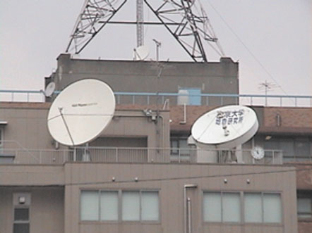
Satellite dishes at the ERI hub of the satellite seismic telemetry
system.
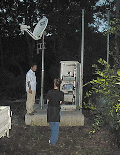
A VSAT station of the satellite seismic telemetry system.
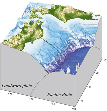
Marine Earthquake Research Group
・Monitoring of crustal activities off Sanriku and around the eastern offshore of Izu Peninsula region using ocean bottom earthquake and tsunami observation stations interlinked by optic cables.
・Understanding of crustal activities near land/sea boundary regions using pop-up type ocean bottom seismometers for long-term observations.
・Surveys of crustal structure below the ocean floor using pop-up type ocean bottom seismometers.
Positions of seismometers and tsunami gauges of the cabled ocean
bottom geophysical observation system and route of the sea floor
optical fiber cable. Circle and triangle indicate ocean bottom
seismometer and tsunami gauge, respectively.
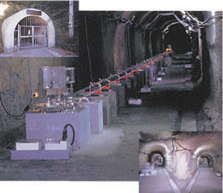
Nokogiriyama Geophysical Observatory: Watertube tiltmeter and
extensometer (center), the inside view of the observation vault
(right lower), and the entrance of the observation vault (left
upper).
Crustal Movement Research Group
・Strain and tilt observations by integrated cave-hole and borehole observations of crustal activities.
・Detection of stress changes by continuous high-precision velocity measurements of elastic wave propagation.
・Measurements of stress in the crust and development of new measurement technique.
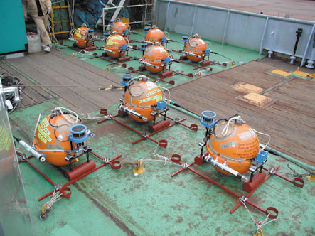
Long-term pop-up type ocean bottom seismometers on ship.
Strong Motion Research Group
・Strong ground motion observation network of a quasi-real-time waveform transmission system in the Suruga Bay, Izu Peninsula, and Ashigara region.