At 7:56PM, August 9th 2009, a Magnitude 7.1(according to USGS) earthquake occurred off south of the Tokaido region.The largest intensity of this earthquake was 4 (on the Japanese scale) , shaking areas from the Tohoku region and to the Kanto region.
Following is a report on this earthquake. (Outreach Office)
[Updated]
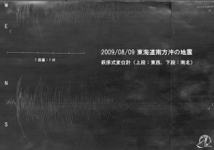
- Smoked-paper recording (Aug 16)
- Earthquake off the east coast of Hachijo-jima around 7:49am at August 13 – earthquake activities in the vicinity (Aug 13)
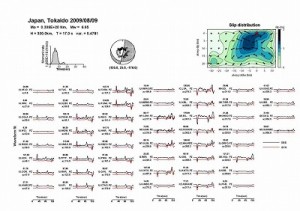
- Source process inversion (Aug 13)
- Relation to the supposed Tokai earthquake(August 9th)
- About the “zone of abnormal seismic intensity”(August 9th)
- Seismicity map around the Tokai region(August 9th)
[Relation to the Supposed Tokai Earthquake]
This earthquake is a deep-focus earthquake related to the Pacific plate, not to the supposed Tokai earthquake at the upper boundary of the Philippine Sea plate.
[About the zone of "abnormal seismic intensity"]
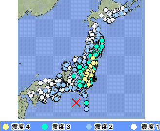
The following is the distribution of seismic intensities for this earthquake (from the website of JMA). It can be seen that the intensities on the Pacific side of the southern Tohoku and Kanto regions were mostly 4, while the intensities around the Tokai and the Kansai regions were 2 to 1.
Such phenomenon where larger intensities are recorded in wide areas farther away from the epicenter rather than the areas closer is called “abnormal seismic intensity”.
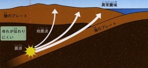
The zone of abnormal seismic intensity can be often observed in case of a deep-focused earthquakes. This is related to the structure of the earth interior. Seismic waves attenuate more when they propagate through the Pacific plate than through the mantle right above the epicenter. The seismic intensity becomes bigger closer to the Pacific plate although it is in a distance from the epicenter.
[Seismicity map around the Tokai region]
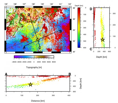
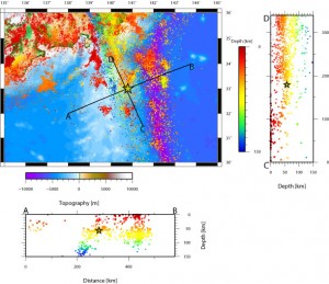
Following is the the seismicity map around the Tokai region for 1907-2006 by JMA. We have plotted all earthquakes with magnitudes of 2.5 or larger in the horizontal chart, and those data within ±20km of the A-B,C-D lateral lines in the cross-section charts.)
[Source Process Inversion]
by Natalia Poiata (D2)
[Smoked-Paper Recording]
At ERI, there are seismographs that has been developed more than 100years ago, and among one of them is the smoked-paper recording seismograph such as the Omori Seismograph. (This is a seismograph well-known to those who have visited ERI for the lab tour or the Open House. ) Seismograms from the Aug 9th earthquake were recorded on these seismographs.
by Technical staffs Atsushi WATANABE and Koji MIYAKAWA
[Earthquake off the East Coast of Hachijo-jima Around 7:49am, August 13- Earthquake Activities in the Vicinity-]
[Links]
