Launched: Jan. 13th, 2010
Updated:March 8th, 2010
A M7.0 earthquake hit southern Haiti at 6:53am, Jan 13, 2010 (Japan time. Local time, 4:53pm, Jan 12). According to the USGS website, location of the epicenter is 18.457°N, 72.533°W, and 13km deep. The earthquake has brought immense catastrophe due to the large magnitude and the shallow epicenter within the crust.
[FAQ]
- Do earthquakes happen frequently in this area?
- Yes. There is a ‘plate boundary’ around the Caribbean Sea that often creates the earthquakes.
- Around which plate boundary did this earthquake occur?
- Between the North American plate (north side) and the Caribbean plate (south side)
- Is it an interplate earthquake? Or a crustal earthquake?
- A crustal earthquake. It is an earthquake that occurred at the Enriquillo fault located south. It is different from the subduction fault which is the boundary with the North American plate.
- What can be said about the mechanism of the earthquake?
- It is a left strike-slip earthquake.
- Other than the strike-slip earthquakes, there are two types of dip-slip earthquakes; a normal fault and a reverse fault.
- Have any earthquakes happened here in the past?
- It is said that earthquakes occurred in 1751 and 1770 at the same Enriquillo fault. No damaging earthquakes seemed to have happened in the past several decades.
- How big was the shake (in 2010)?
- It is almost the same as the Great Hanshin Earthquake in 1995. Considering the shallow epicenter, the magnitude of the earthquake, the strike-slip fault mechanism, crustal earthquake, and the fact that it hits the urban area, this Haiti earthquake can be compared to the Kobe earthquake in 1995 that resulted in the Great Hanshin Earthquake.
[Tectonics background]
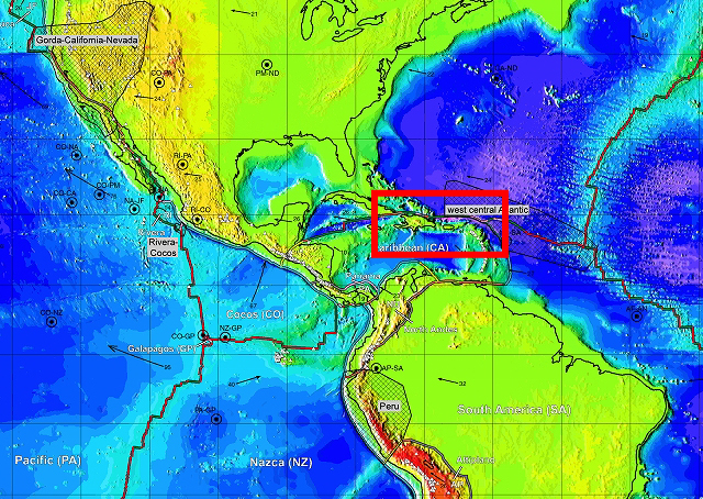
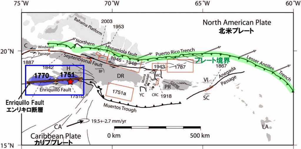
The earthquake occurred close to the boundary of the Caribbean plate and the Northern American plate. The Caribbean plate is moving eastward with the rate of 20mm/yr with respect to the Northern American plate.

(Bird, P. (2003) An updated digital model of plate boundaries, Geochemistry Geophysics Geosystems, 4(3), 1027, doi:10.1029/2001GC000252) Below is the enlarged map within the red square
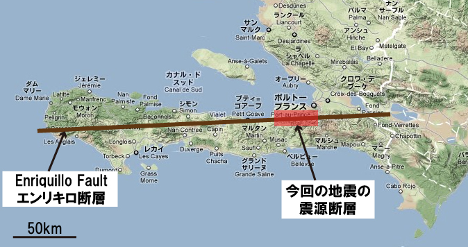
At Haiti, located in the western part of the Hispaniola Island, the Septentrional fault and the Enriquillo fault run at the north and the south, respectively. Both are strike-slip faults. The earthquake on January 13 occurred at the Enriquillo fault down south (moving speed: 8mm/yr), with a left strike-slip mechanism. Earthquakes has occurred around this fault in 1751 and in 1770.
The earthquake on January 13 occurred at the Enriquillo fault down south (moving speed: 8mm/yr), with a left strike-slip mechanism. Earthquakes has occurred around this fault in 1751 and in 1770.
 The red square indicates the earthquake on Jan 13.
A tsunami of 12cm was observed at Santo Domingo, capital of Dominican Republic, the eastern side of Hispaniola Island.
Reference
- Manaker, D.M. et al., 2008. Interseismic Plate coupling and strain partitioning in the Northeastern Caribbean, Geophys. J. Int., 174,889-903
[Source process inversion of teleseismic body waves]
Janurary 12, 2010 Haiti Earthquake
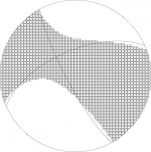
[Focal mechanism by w-phase seismogram]
(Click figure for larger image and PDF)
- Mw: 7.06
- strike: 246.6,dip: 62.6,slip: 10.8
(by Yusuke YOKOTA, Division of Disaster Mitigation Science)
[Link]
- USGS “M7.0 Haiti Region”
- The MW 7.0 Haiti earthquake of January 12, 2010;
USGS/EERI Advance Reconnaissance Team report

