Launched: October 1st, 2013
On 24th September 2013, a magnitude 7.7 earthquake occured in Pakistan.
Data: High frequency P waveforms from ~700 Hi-net stations and ~200 European stations were used in a back projection analyses of the rupture for the September 24, 2013 Pakistan earthquake (Figure 1).
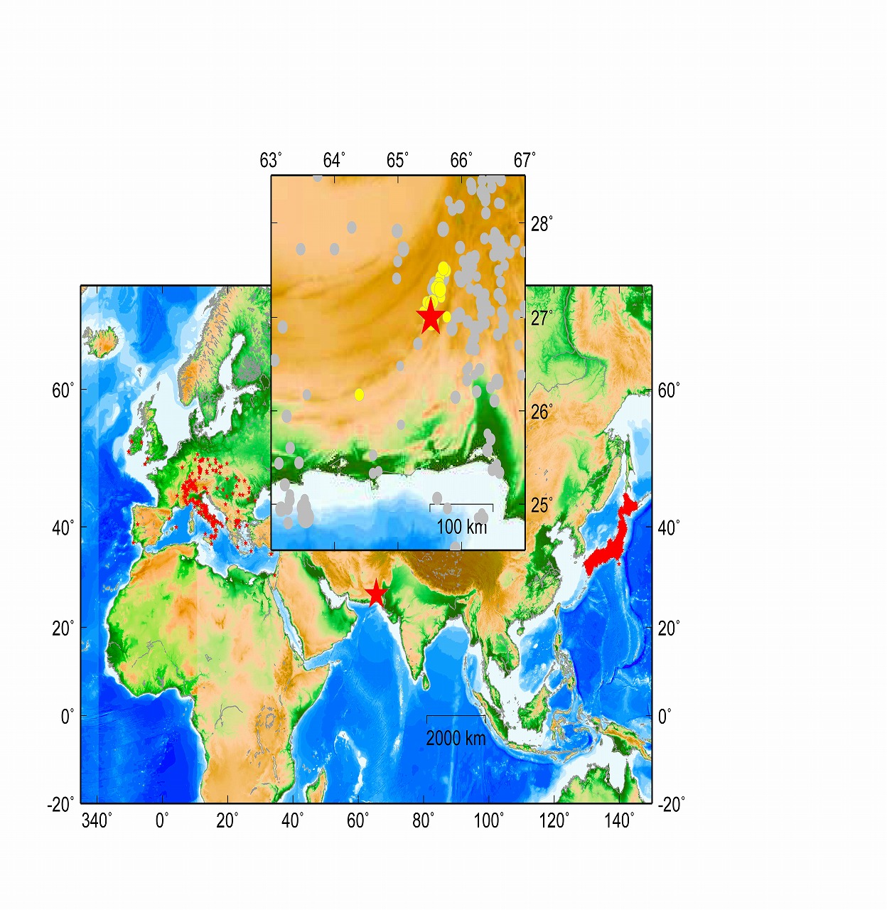
Figure 1. Distribution of Hi-net and European stations (red triangles) with respect to the epicenter of the September 24, 2013 Mw 7.7 Pakistan earthquake, as determined by USGS (red star). The inset shows the aftershocks (yellow circles) for three days following the mainshock and the background seismicity (gray circles).
Method: see Wang and Mori, 2011, EPS, and Wang and Mori, 2011, GRL.
Results: The back projection results suggest that the rupture mainly propagated to the southwest for about 150 km in space and 40 to 50 s in time (Figures 2). The located trace is not consistent with the aftershock distribution that suggests a north rupture extent. The slip model from finite waveform inversion (T. Lay, personal communication) shows that ~80% of the seismic moment were released in the north patch that is spatially correlated with the aftershock distribution. The rupture speed is very fast, ~4 km/s, which is much faster than local S wave velocity of ~3.5 km/s, suggesting another possible supershear rupture.
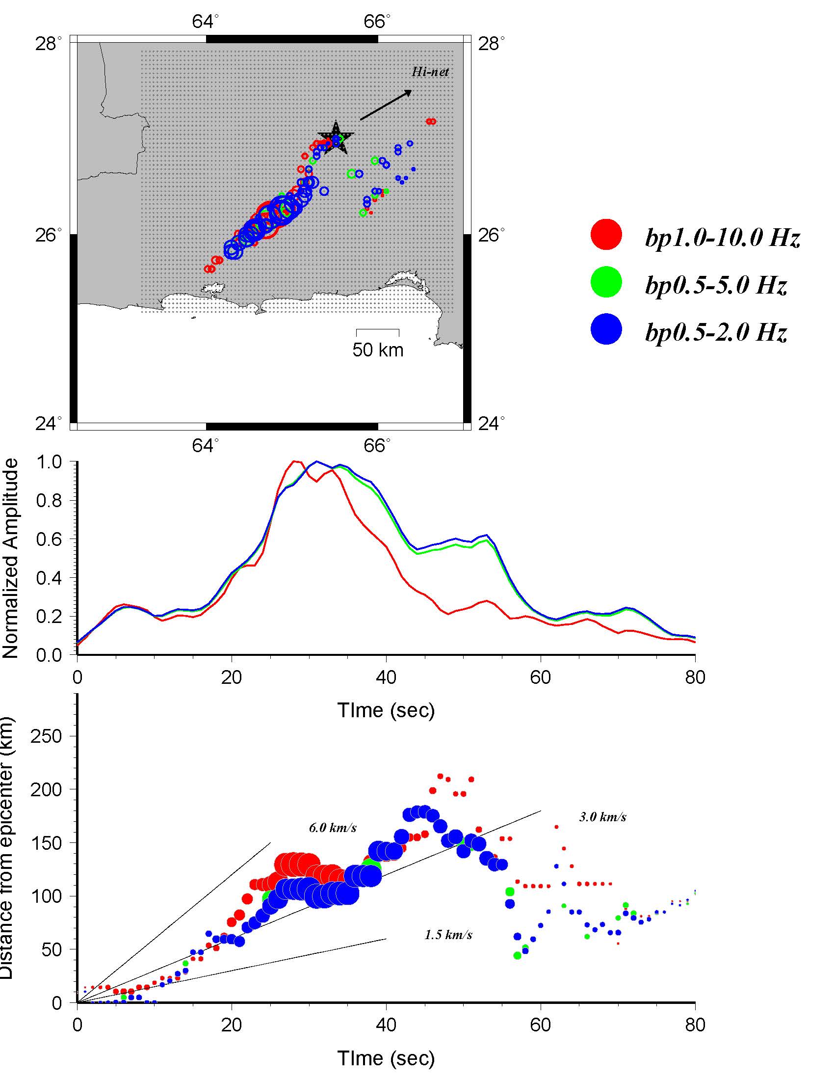
Figure 2. (a): Top: Locations, timings and amplitudes for the stack with the maximum correlation at each time step (1 s) derived from Hi-net. Grid points indicate the tested source locations. Middle: Normalized value of the maximum amplitudes (sums of squared amplitude stacks) in each time window as a function of time. Bottom: Distance as a function of time for the locations of the maximum stack amplitude in each time window. The distance is measured from the epicenter. Colored lines show the slope of rupture velocities of 1.5, 3.0 and 6.0 km/s for reference.
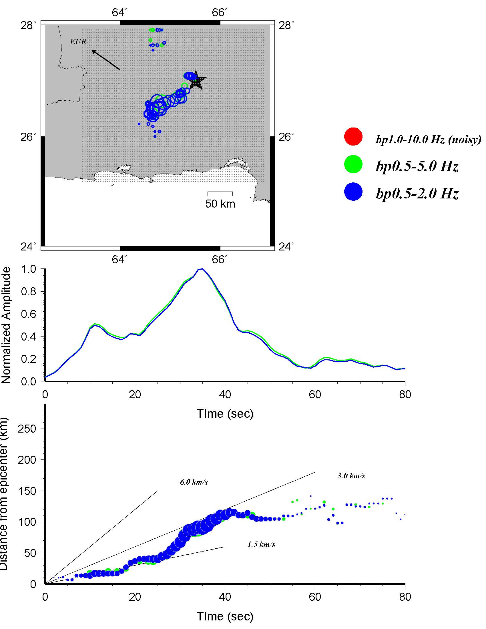
(b): The same as (a) for the EUR data
Another special issue for this earthquake is that an island emerged off Gwadar coast after this earthquake. Seismologists believe the formation is due to a mud volcano. But the mud volcano is 400 km from the epicenter, which is much farther than for past cases with a distance of less than 200 km. Perhaps the strong high frequency energy toward southeast as revealed by back projection account for this, but need further investigation.
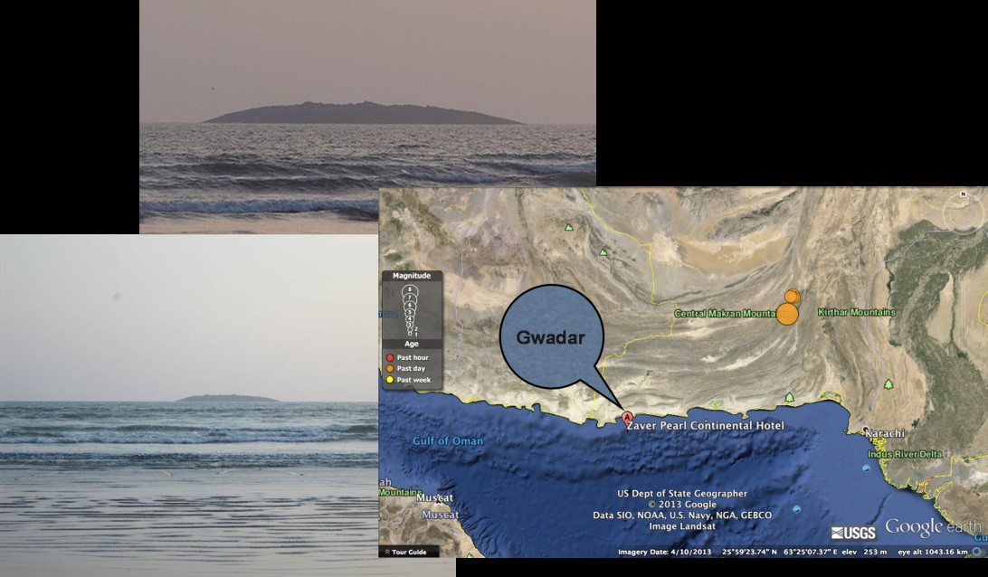
Figure 3. Location of the mud volcano activated by the earthquake (photos are from http://www.smh.com.au and http://www.nbcnews.com).
(Ocean Hemisphere Research Center : Dr. Wang Dun)