Top Next
7-4. 2000 Tottoriken-Seibu earthquake
The 2000 Tottoriken-Seibu earthquake (M7.3, temporally determined) occurred
on October 6. Figure
1 shows an aftershock distribution from Oct. 6 to Jan. 16, 2000, located
by the combined DPRI's
data(KYT) with Hi-net. The aftershock distribution was about 30 km
long in the direction of NNE-SSW,
and shallower than 15 km. The mainshock hypocenter was determined at
a depth of about 5 km. Yellow
circles indicate the temporal microseismic observation stations installed
by the Japanese university
group of the urgent joint observation for the 2000 Tottoriken-seibu
Earthquake in order to investigate
precise crustal structure and focal mechanisms and etc..
The rupture process of the Tottoriken-Seibu earthquake is revealed
using strong motion
seismograms installed around the source region. The spatial distribution
of final slip is shown in Fig. 2.
The fault plane on the south side of the epicenter has 14 km long and
13 km wide with the strike of
N142°E, and that on the north side has 16 km long and 13 km wide with
the strike of N158°E. The
large slip area lies around the hypocenter with the depth of 2 km to
6 km deep. The largest slip and the
seismic moment are 4m and 1.2 x 10 19 Nm, respectively.
To observe the postseismic deformation we deployed newly developed
one frequency GPS receivers
from October 11 to December 27, 2000. The linear GPS array was constructed
around the epicenter
and it is perpendicular to the aftershock distribution. Figure 3 shows
the average horizontal
displacement from October 11 to November 2, 2000. The postseismic deformation
was observed.
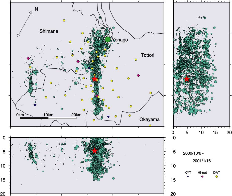
Fig.1. Aftershock distribution of an earthquake of October 6, 2000
in the Western Part
of Tottori Prefecture (Oct. 2000 - Jan. 2001).
The aftershocks were located in
shallower
than 15 km by the combined DPRI's data(KYT) with Hi-net.
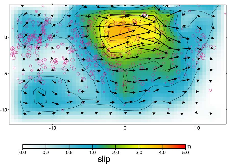
Fig.2. Rupture process of the Tottoriken-Seibu earthquake viewing
from the west.
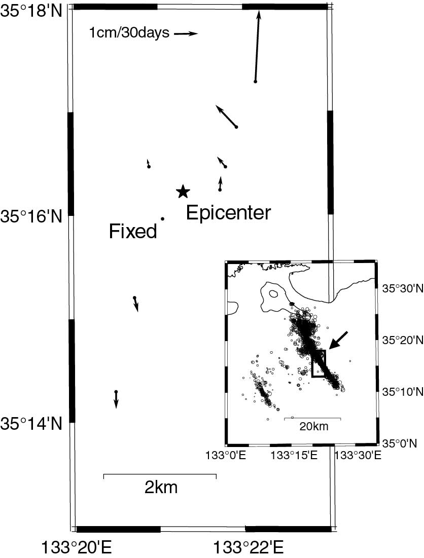
Fig.3. Average horizontal deformation vector between October 11 and
November 2.
Top Next