5-5 Developments
of the measuring technology addressed for marine geodesy
To measure the crustal
deformation on the seafloor is very important to know the distributions of the
strain and stress in the vicinity of the plate boundary where large earthquakes
occur. We developed GPS/acoustic seafloor positioning system (Fig.1). The
precision acoustic transponder (PXP) system is the key component of the
positioning system. We developed the PXP system for precise ranging over 10 km
that is necessary for precise positioning of a point on the Pacific plate at a
water depth over 6 km (Fig.2). The other key component is the system for the
kinematic GPS positioning at the sea surface at a baseline length of several
hundreds of kilometers. During the measurements, we tow a buoy system that
install 3 GPS receivers, acoustic ranging instruments and a radio link to lower
the acoustical noises generated by a research vessel (Fig.3).
We examined the system near Hawaii Island and seaward of
the Japan Trench in 2001. We succeeded in receiving acoustic signals at slant
ranges more than 15 km. The fluctuations of the positions are estimated to be
less than 10 cm
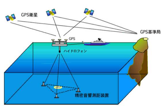
Fig.1. Schematic diagram of GPS/acoustic seafloor
positioning system. The distances between the transducer that is fixed on the
bottom of the buoy and the precision acoustic transponder (PXP) systems on the
seafloor are measured acoustically. The position of the transducer is
calculated from the buoy-GPS data.
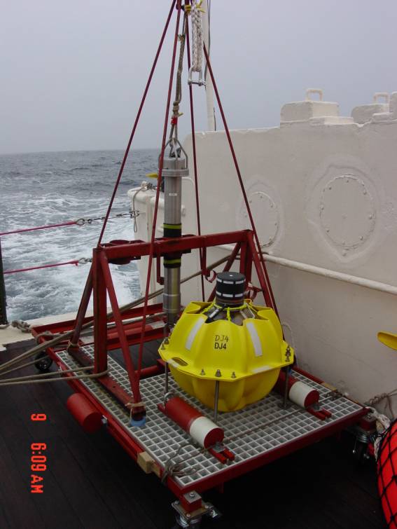
Fig.2. The precision acoustic transponder (PXP) system.
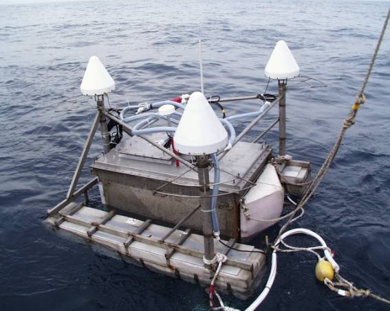
Fig.3. The buoy system that installs 3 GPS receivers and an acoustic transducer.