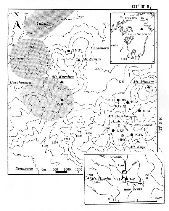
Fig. 8 Location map of Kuju Volcano and its surroundings. Triangles indicate summits of mountains, and closed and shadowed circles indicate seismic stations. Hacchobaru, Sujiyu and Yutsubo geothermal regions, where seismic swarms occurred, are also labelled. A, B and C above the inset map are the pre-existing fumarolic active fields of the Ioyama area. Also in this inset are the new vents (after Sudo et al. 1998).