Top Next
6-5. Application of the Global Positioning System
The Global Positioning System (GPS) is a space geodetic technique to
estimate accurate ground
coordinates and their temporal changes. The GPS research team in ERI
established a nationwide
research group called Japanese University Consortium for GPS Research
(JUNCO) among related GPS
researcheres in 1988. The group has promoted and conducted a variety
of GPS projects of different
scale of crustal deformations. Local dense array project in the Izu
peninsula and the deformation
monitoring project after the 1995 Hyogoken-Nanbu earthquake are the
examples. In addition JUNCO
has established an international permanent GPS network in the western
Pacific area (see the part of
the Ocean Hemisphere Project, 5-3). Numerical analysis based on the
observed geodetic data is of
special interest of the ERI group. Figure 1 shows the crustal deformations
due to a swarm activity off
Ito that occurred in March 1997, and Figure 2 shows the estimated temporal
evolution of open crack
on the source plane based on the geodetic data. This approach may be
important for help
understanding crustal process as well as for providing basic database
for forcasting crustal activity.
Other basic researches include applications of kinematic GPS for detecting
sea-floor crustal
deformations and to GPS buoy and applications to meteorology, climatology.
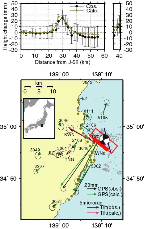
Figure 1. Crustal deformation observed at a swarm activity that occurred
in March,1997 off Ito area. Arrows are the horizontal displacements by
GPS and dotted curve in the above inset are the levelling results (Aoki
et al., 1999).
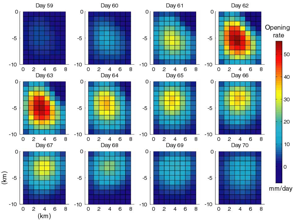
Figure 2. Daily evolution of open crack velocity distribution on the source
area of theswarm that runs WNW-ESE. Upward migration of the cenroid open
crack is visible, which may indicate the upward dike intrusion (Aoki et
al., 1999).
Top Next