Website launched: 4th January, 2024 (JST)
Last updated: 17th January, 2024 (JST)
An earthquake 7.6 Mw(according to JMA) occurred on 1st January 2024 at around 16:10 p.m. JST, in Noto peninsula, Ishikawa Prefecture. We will be updating latest investigation and analysis on this webpage.
*All figures/pictures/movies should be credited as: “Earthquake Research Institute, The University of Tokyo” for citation. Also, please report via contact form upon usage.
*Information on this page is updated occasionally.
2024/01/17
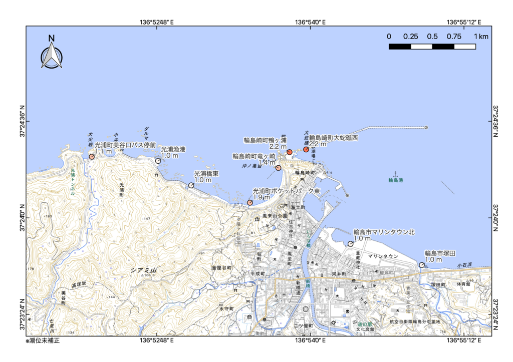
Coseismic coastal uplift associated with 2024 Noto Peninsula Earthquake (Preliminary Report 4)
Tatsuya Ishiyama (Earthquake Research Institute, the University of Tokyo), Ryo Tateishi (University of Toyama), Ken-ichi Yasue (University of Toyama)
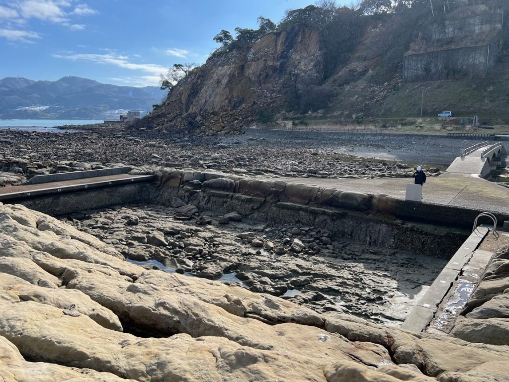
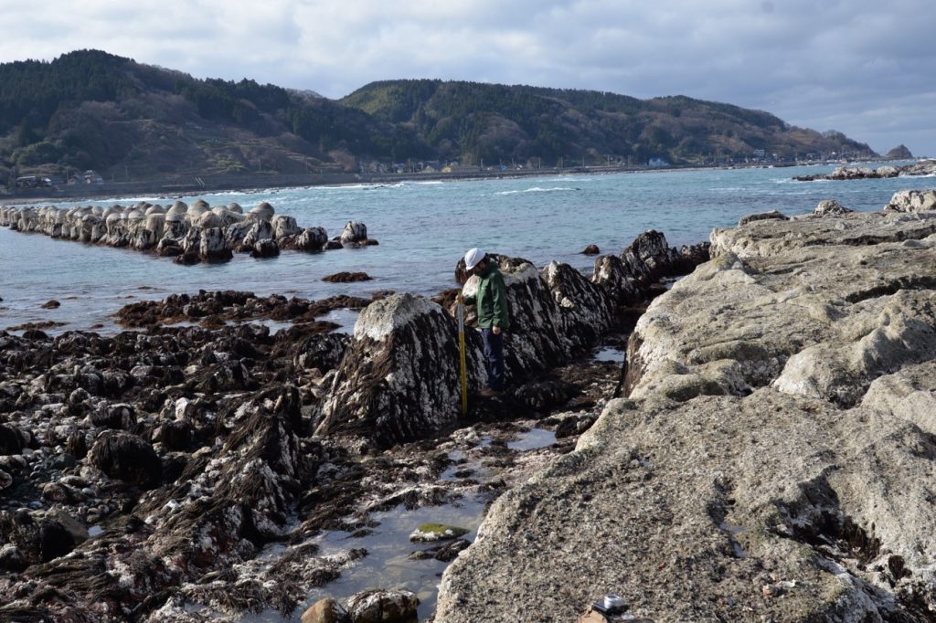
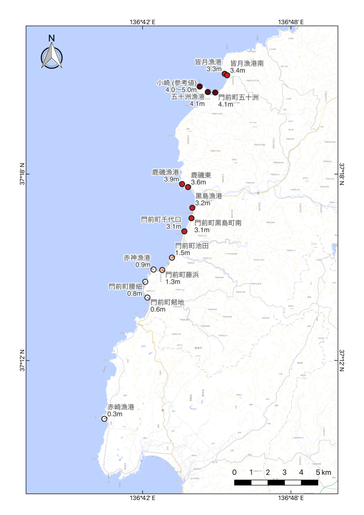
During a field investigation along the northwest coast of the Noto Peninsula, we found evidence of coseismic coastal uplift related to the Noto Peninsula Earthquake (M7.6) (HERP, 2024) around central Wajima city, in addition to previous results (Ishiyama et al., 2004a, b, c). (Figs. 1 to 4). The heights of emerging sea weeds at Kamogaura and Tatsugasaki sites were used to measure about 2.2 m and 1.4 m of coseismic uplift respectively, without taking tidal changes into account (Fig. 2 and 4). Estimated coseismic uplift in this area decrease both east-and westward from the Kamogaura site along the coastline, in accordance with geodetically estimated crustal deformation (Geospatial Information Authority of Japan, 2024).
References
-Geospatial Information Authority of Japan, 2024, Crustal deformation associated with the 2024 Noto Peninsula earthquake detected by DAICHI 2 data(January 16, 2024 updated), https://www.gsi.go.jp/uchusokuchi/20240101noto_insar.html (January 16, checked)
-HERP, 2024, Evaluation of the 2024 Noto Peninsula earthquake, https://www.static.jishin.go.jp/resource/monthly/2024/20240101_noto_2.pdf(January 16, 2024 checked)
-Ishiyama, T., Matta, N., Tateishi, R., Yasue, K., 2024a, Coseismic coastal uplift associated with 2024 Noto Peninsula Earthquake (Preliminary Report), https://www.eri.u-tokyo.ac.jp/en/news/5994/ (January 4, 2024 checked)
-Ishiyama, T., Hirouchi, D., Matta, N., Tateishi, R., Yasue, K., 2024b, Coseismic coastal uplift associated with 2024 Noto Peninsula Earthquake (Preliminary Report 2), https://www.eri.u-tokyo.ac.jp/en/news/5994/ (January 5, 2024 checked) Ishiyama, T., Hirouchi, D., Matta, N., Tateishi, R., Yasue, K., 2024c, Coseismic coastal uplift associated with 2024 Noto Peninsula Earthquake (Preliminary Report 3), https://www.eri.u-tokyo.ac.jp/en/news/5994/ (January 9, 2024 checked)
Coseismic coastal uplift associated with 2024 Noto Peninsula Earthquake (Preliminary Report 3)
Tatsuya Ishiyama (Earthquake Research Institute, the University of Tokyo), Daisuke Hirouchi (Shinshu University), Nobuhisa Matta (Okayama University), Ryo Tateishi (University of Toyama), Ken-ichi Yasue (University of Toyama)
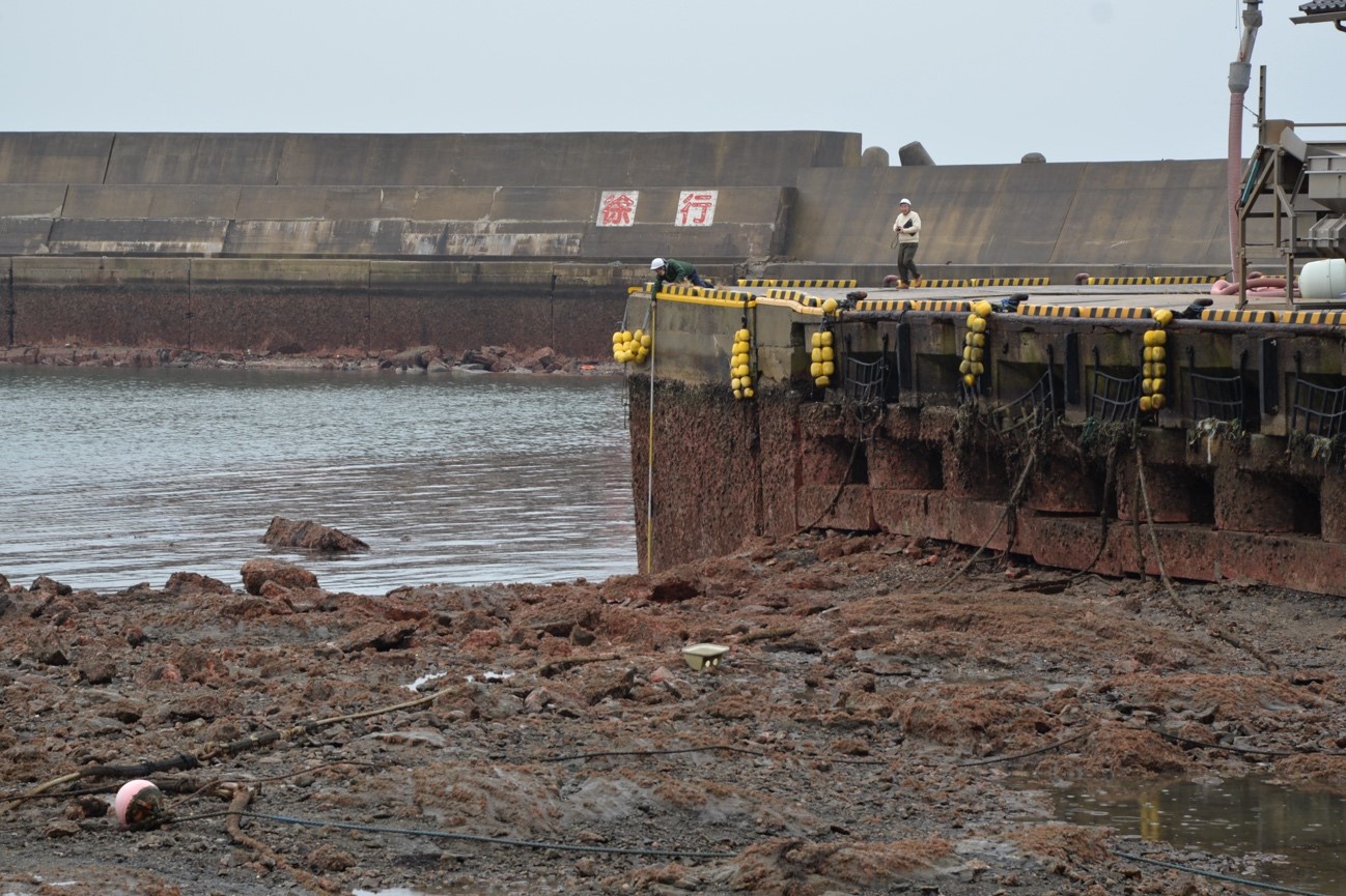
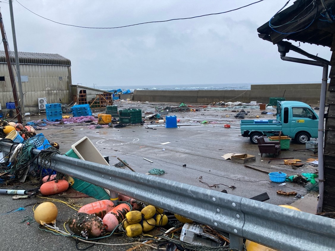
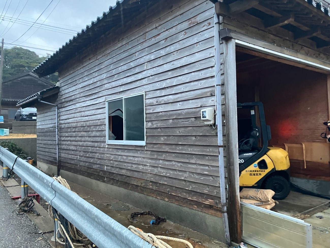
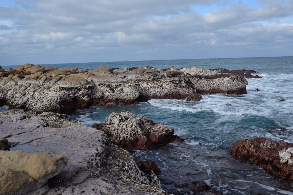
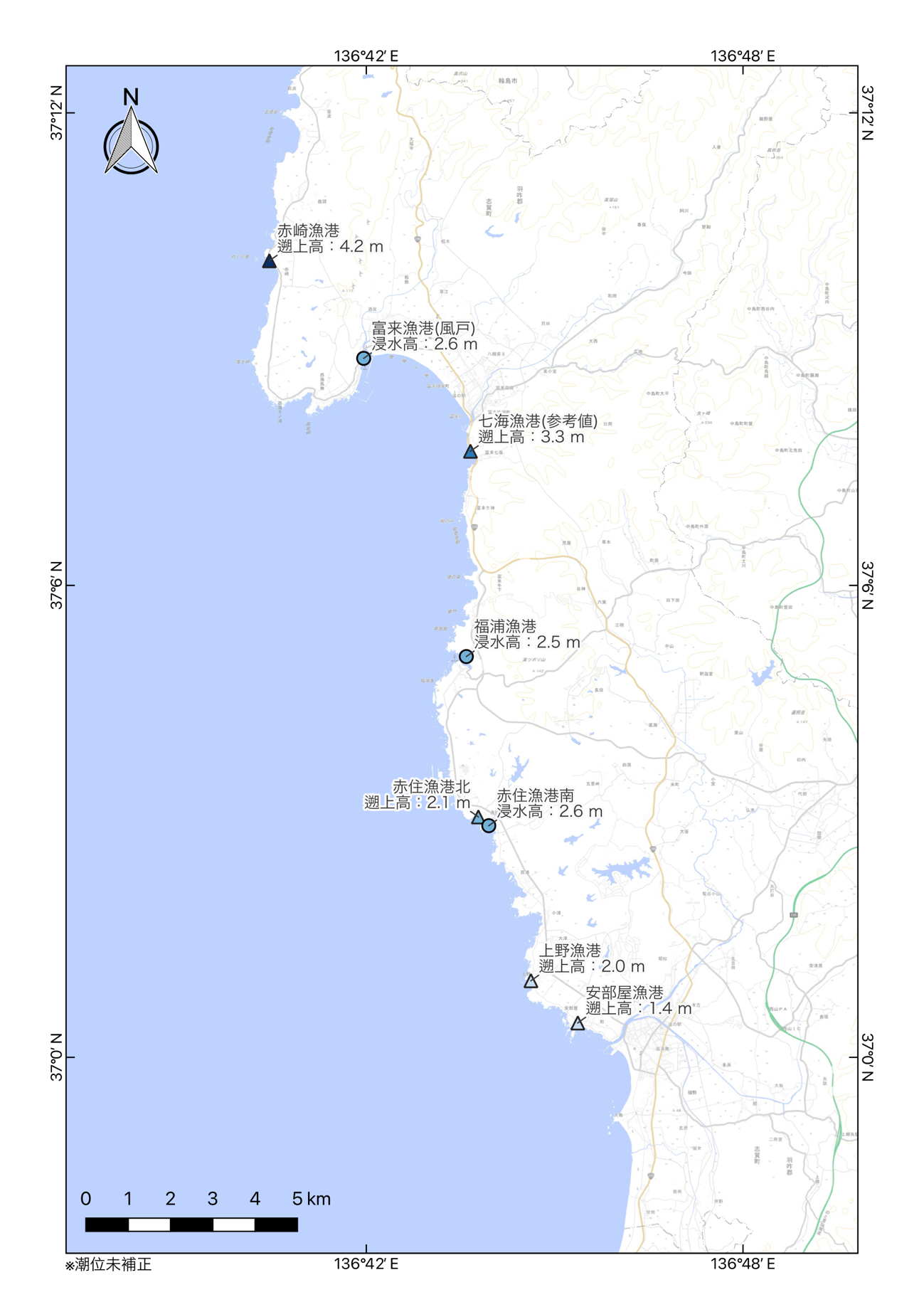
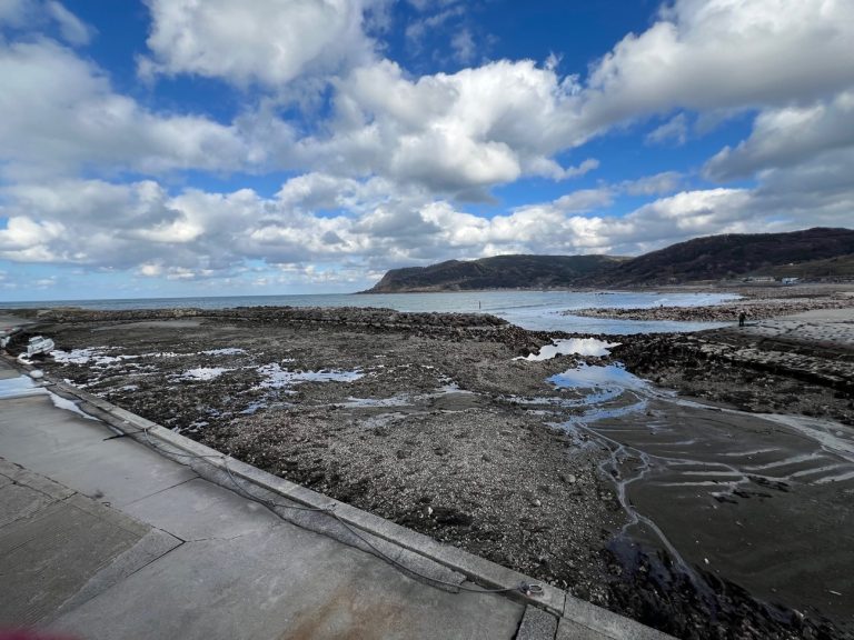
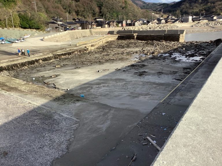
During a field investigation along the northwest coast of the Noto Peninsula, we found evidence at more locations of coseismic coastal uplift and tsunami traces related to the Noto Peninsula Earthquake (M7.6) (HERP, 2024). (Figs. 1 and 2). The heights of emerging shells and sea weeds at Sen-no-ura site were used to measure about 0.2 m of coseismic uplift, without taking tidal changes into account (Fig. 2 and 3). We also identified potential onshore tsunami traces at seven locations (Figs. 2, 3, 4 and 5), some of which are confirmed by interviews, where the estimated tsunami run-up and inundation heights span between about 1.4 m and 2.6 m. Combined with results from Ishiyama et al. (2024a, 2024b), coseismic coastal uplift and tsunami appear to occur along the northwest coast of the Noto peninsula.
References
-Ishiyama, T., Matta, N., Tateishi, R., Yasue, K., 2024a, Coseismic coastal uplift associated with 2024 Noto Peninsula Earthquake (Preliminary Report), https://www.eri.u-tokyo.ac.jp/en/news/5994/ (January 4, 2024 checked)
-Ishiyama, T., Matta, N., Tateishi, R., Yasue, K., 2024b, Coseismic coastal uplift associated with 2024 Noto Peninsula Earthquake (Preliminary Report), https://www.eri.u-tokyo.ac.jp/en/news/5994/ (January 5, 2024 checked)
-HERP, 2024, Evaluation of the 2024 Noto Peninsula earthquake, https://www.static.jishin.go.jp/resource/monthly/2024/20240101_noto_1.pdf(January 2, 2024 checked)
-Shishikura, M., Echigo, T., Namegaya, Y., 2020, Activity of the offshore active faults along the northern coast of the Noto Peninsula deduced from the height distribution of the lower marine terrace and emerged sessile assemblage, Active Fault Research, 53, 33-49.
due to the 2024 Noto Peninsula earthquake based on our field survey.
inundation heights due to the 2024 Noto Peninsula earthquake based on our field
survey.
at Togi port.
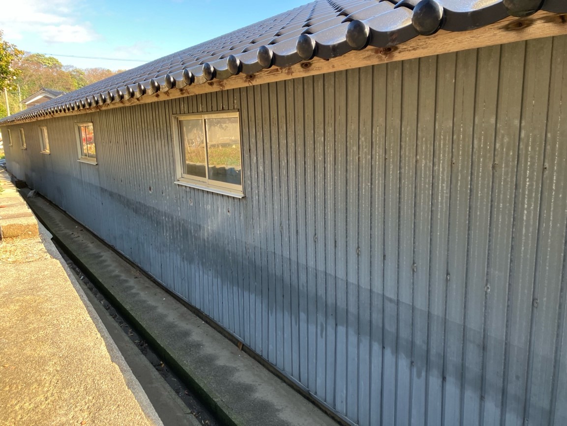
at Akasumi port (south).
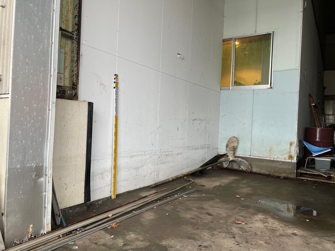
at Ueno port. Floor was covered by a thin sand layer presumably transported by
tsunami associated with the 2024 Noto Peninsula earthquake.
Coseismic coastal uplift associated with 2024 Noto Peninsula Earthquake (Preliminary Report 2)
Tatsuya Ishiyama (Earthquake Research Institute, the University of Tokyo), Daisuke Hirouchi (Shinshu University), Nobuhisa Matta (Okayama University), Ryo Tateishi (University of Toyama), Ken-ichi Yasue (University of Toyama)
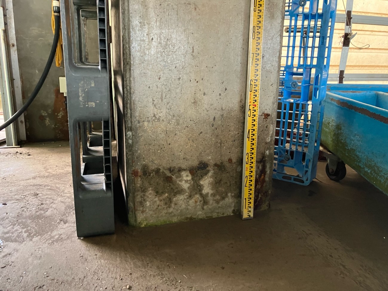
During a field investigation along the northwest coast of the Noto Peninsula, we found evidence at five more locations along the Minazuki coast, of coseismic coastal uplift related to the Noto Peninsula Earthquake (M7.6) (HERP, 2024). (Fig. 1). The heights of emerging shells and sea weeds at the Igisu and Minazuki port were used to measure about 4.1 m and 3.3 m of coseismic uplift, without taking tidal changes into account (Fig. 2 and 3). We also obtained interviews confirming that the earthquake and coastal uplift occurred simultaneously. Combined with results from Ishiyama et al. (2024), coseismic coastal uplift appears to occur along the northwest coast of the Noto peninsula from Minazuki to Akasaki. Our initial estimates on coseismic uplift along the Minazuki coast is comparable to the height of former shorelines of Holocene marine terraces (Shishikura et al., 2020), implying that Holocene marine terraces and emerging sessile assemblages have formed associated with repeated large paleo-earthquakes similar to the 2024 event.
References
-Ishiyama, T., Matta, N., Tateishi, R., Yasue, K., 2024, Coseismic coastal uplift associated with 2024 Noto Peninsula Earthquake (Preliminary Report), https://www.eri.u-tokyo.ac.jp/en/news/5994/ (January 4, 2024 checked)
-HERP, 2024, Evaluation of the 2024 Noto Peninsula earthquake, https://www.static.jishin.go.jp/resource/monthly/2024/20240101_noto_1.pdf(January 2, 2024 checked)
-Shishikura, M., Echigo, T., Namegaya, Y., 2020, Activity of the offshore active faults along the northern coast of the Noto Peninsula deduced from the height distribution of the lower marine terrace and emerged sessile assemblage, Active Fault Research, 53, 33-49.
Coseismic coastal uplift associated with 2024 Noto Peninsula Earthquake (Preliminary Report)
Tatsuya Ishiyama (Earthquake Research Institute, the University of Tokyo), Nobuhisa Matta (Okayama University), Ryo Tateishi (University of Toyama), Ken-ichi Yasue (University of Toyama)
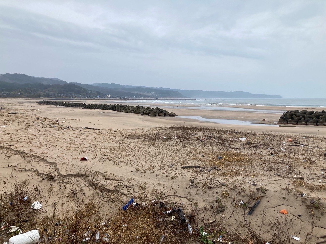
During a field investigation along the northwest coast of the Noto Peninsula, we found evidence at ten locations, from Kaiso to Akasaki sites, of coseismic coastal uplift related to the Noto Peninsula Earthquake (M7.6) (HERP, 2024). (Fig. 1). The heights of emerging shells and sea weeds at the Kaiso port were used to measure about 3.9 m of coseismic uplift, without taking tidal changes into account (Fig. 2 and 3). There was also evidence of approximately 250 meters of seaward migration of the sandy coastal line due to coseismic uplift and approximately 3.2 meters of coseismic uplift east of the Kaiso port (Fig. 4). The pattern of estimated coseismic coastal uplift appears to be decreasing southward from Kaiso to Akasaki, in accordance with geodetically estimated crustal deformation (Geospatial Information Authority of Japan, 2024). Additionally, we identified potential onshore tsunami traces at Akasaki port (Figs. 5 and 6), where the estimated tsunami run-up height was 4.2 m and the coseismic uplift was around 0.25 m. Based on our initial findings, it appears that there is also geomorphic evidence for coseismic coastal uplift along the northern coast of the Noto peninsula above the mainshock source, where uplifted Holocene marine terraces and emerging sessile assemblages have been identified (Shishikura et al., 2020).
References
-HERP, 2024, Evaluation of the 2024 Noto Peninsula earthquake, https://www.static.jishin.go.jp/resource/monthly/2024/20240101_noto_1.pdf(January 2, 2024 checked)
-Geospatial Information Authority of Japan, 2024, Crustal deformation associated wirh the 2024 Noto Peninsula earthquake detected by DAICHI 2 data, https://www.gsi.go.jp/uchusokuchi/20240101noto.html (January 2, 2024 checked)
Shishikura, M., Echigo, T., Namegaya, Y., 2020, Activity of the offshore active faults along the northern coast of the Noto Peninsula deduced from the height distribution of the lower marine terrace and emerged sessile assemblage, Active Fault Research, 53, 33-49.