Iyan E. Mulia1, Takeo Ishibe2, Kenji Satake1, Aditya Riadi Gusman3 & Satoko Murotani 4
1Earthquake Research Institute, The University of Tokyo 2Association for the Development of Earthquake Prediction, Tokyo, Japan 3GNS Science, Lower Hutt, New Zealand 4National Museum of Nature and Science, Ibaraki, Japan
Earth Planets Space 72, 123 (2020). https://doi.org/10.1186/s40623-020-01256-5
Abstract
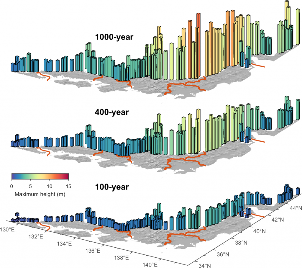
We analyze the regional tsunami hazard along the Sea of Japan coast associated with 60 active faults beneath the eastern margin of the Sea of Japan. We generate stochastic slip distribution using a Monte Carlo approach at each fault, and the total number of required earthquake samples is determined based on convergence analysis of maximum coastal tsunami heights. The earthquake recurrence interval on each fault is estimated from observed seismicity. The variance parameter representing aleatory uncertainty for probabilistic tsunami hazard analysis is determined from comparison with the four historical tsunamis, and a logic-tree is used for the choice of the values. Using nearshore tsunami heights at the 50 m isobath and an amplification factor by the Green’s law, hazard curves are constructed at 154 locations for coastal municipalities along the Sea of Japan coast. The highest maximum coastal tsunamis are expected to be approximately 3.7, 7.7, and 11.5 m for the return periods of 100-, 400-, and 1000-year, respectively. The results indicate that the hazard level generally increases from southwest to northeast, which is consistent with the number and type of the identified fault systems. Furthermore, the deaggregation of hazard suggests that tsunamis in the northeast are predominated by local sources, while the southwest parts are likely affected by several regional sources.