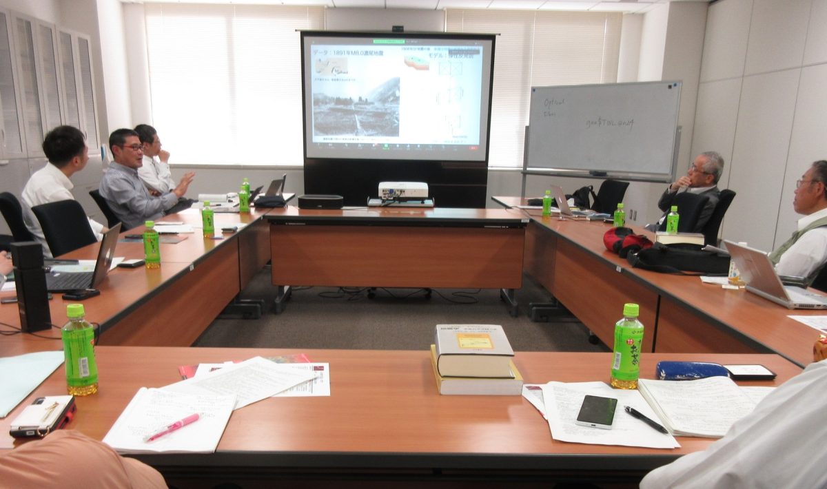
巨大地震・巨大津波に関する国際研究集会 -2004年スマトラ・アンダマン地震から20年間の進歩と今後の展望- The International Workshop on Mega Earthquakes and Tsunamis – Progress in 20 Years since the 2004 Sumatra-Andaman Earthquake and Future Perspectives
Title: Assessing the Impact of Very Early Postseismic Slip on Fault Slip Budget
Abstract:
Earthquakes are very often, if not always, followed by a relaxation phase, the post-seismic phase. During this time, the fault continues to slip both seismically and aseismically, contributing to the overall earthquake slip budget. Since the intensity of the post-seismic phase is known to decrease exponentially with time, monitoring the very early stage of the post-seismic phase is key to an accurate assessment of the fault slip budget. To access the first hours of the post-seismic phase, we have adopted an innovative processing strategy for the GNSS data to obtain position time series with high temporal resolution (30 seconds) and starting from 5 minutes after the earthquakes. In this talk, I will first give an overview of the results we have obtained from the analysis of the very early stage of the post-seismic phase, with a focus on how this affects the estimation of the fault slip budget. Then I will present the project that motivates my 3-month visit to the ERI.
参考文献 Koyaguchi, T. and Ohno, M. (2001). Reconstruction of eruption column dynamics on the basis of grain size of tephra fall deposits: 2. Application to the Pinatubo 1991 eruption, J. Geophys. Res., 106(B4), 6513–6533.
Miyagi, N. et al. (2011). High-resolution reconstruction of the Hoei eruption (AD 1707) of Fuji volcano, Japan, J. Volcanol. Geotherm. Res., 207, 113–129.
Suzuki, Y. J. and Iguchi, M. (2019). Determination of the mass eruption rate for the 2014 Mount Kelud eruption using three-dimensional numerical simulations of volcanic plumes, J. Volcanol. Geotherm. Res., 382, 42–49.
Surface ruptures appeared along the Wakayama-gawa River associated with 2024 Noto Peninsula Earthquake (Preliminary Report)
白濱吉起(東京大学地震研究所)・石山達也(東京大学地震研究所)・立石 良(富山大学)・安江健一(富山大学) Yoshiki Shirahama (Earthquake Research Institute, the University of Tokyo), Tatsuya Ishiyama (Earthquake Research Institute, the University of Tokyo), Ryo Tateishi (University of Toyama), Ken-ichi Yasue (University of Toyama)
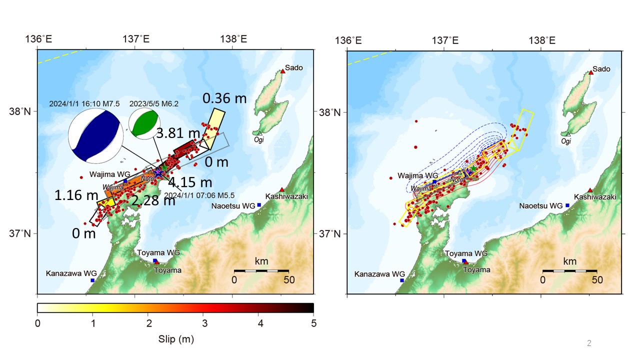
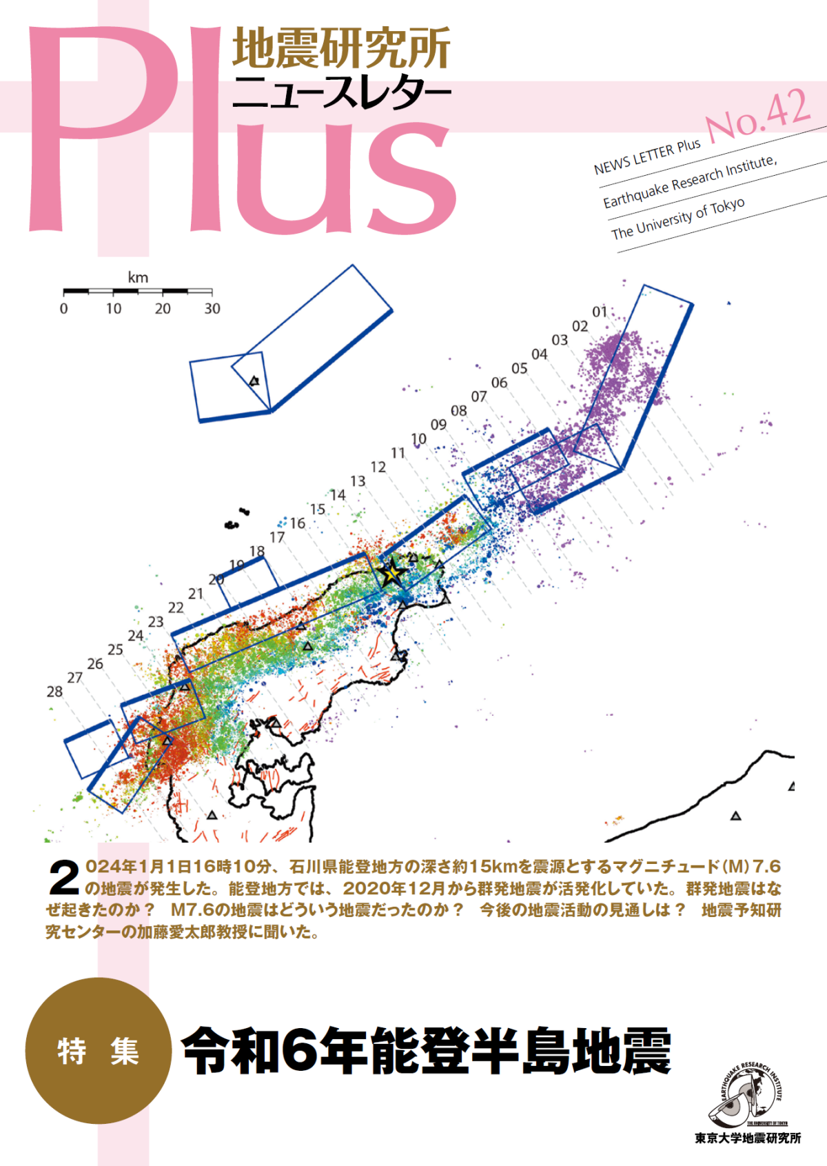
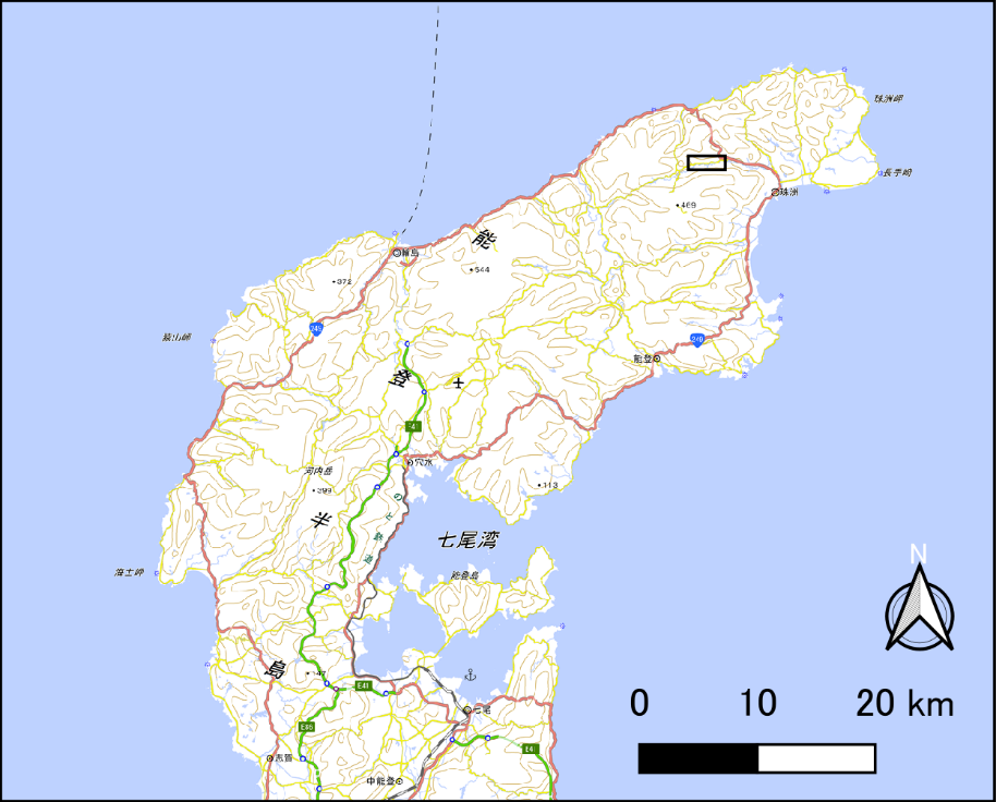
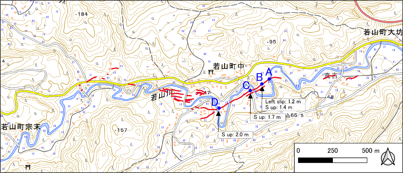
2024 年1月1日16時10分に、石川県能登地方の深さ約15 km でM7.6(暫定値)の地震が発生した。地震の発震機構は北西-南東方向に圧力軸を持つ逆断層型で、上部地殻内で発生した地震である(地震本部, 2024)。この地震に伴う内陸の地表変状の把握のため、国土地理院が地震後に公開した1月2日撮影の空中写真(国土地理院, 2024a)の判読を行った結果、若山川沿いに分布する一連の地表変状を見出した(図1a, b)。これらの地表変状を現地にて観察するため、1月27日に若山町中地区を中心として東西2㎞の範囲にわたって地形調査を実施した。その結果、若山川沿いに発達する河成段丘面および現河床を横断して、地表地震断層と推定される崖地形が連続的に分布し、これに沿って顕著な田畑や道路の破断、波状変形が認められることがわかった。
令和6年能登半島地震(M7.6)で生じた海岸隆起【速報その3】 Coseismic coastal uplift associated with 2024 Noto Peninsula Earthquake (Preliminary Report 3)
石山達也(東京大学地震研究所)・廣内大助(信州大学)・松多信尚(岡山大学)・立石 良(富山大学)・安江健一(富山大学) Tatsuya Ishiyama (Earthquake Research Institute, the University of Tokyo), Nobuhisa Matta (Okayama University), Daisuke Hirouchi (Shinshu University), Ryo Tateishi (University of Toyama), Ken-ichi Yasue (University of Toyama)
Tatsuya Ishiyama (Earthquake Research Institute, the University of Tokyo), Nobuhisa Matta (Okayama University), Daisuke Hirouchi (Shinshu University), Ryo Tateishi (University of Toyama), Ken-ichi Yasue (University of Toyama)
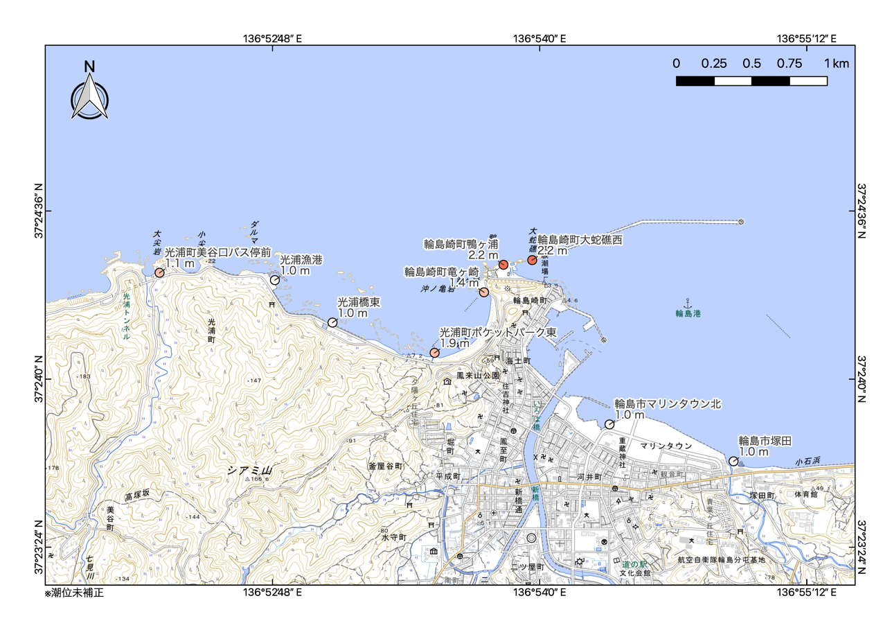
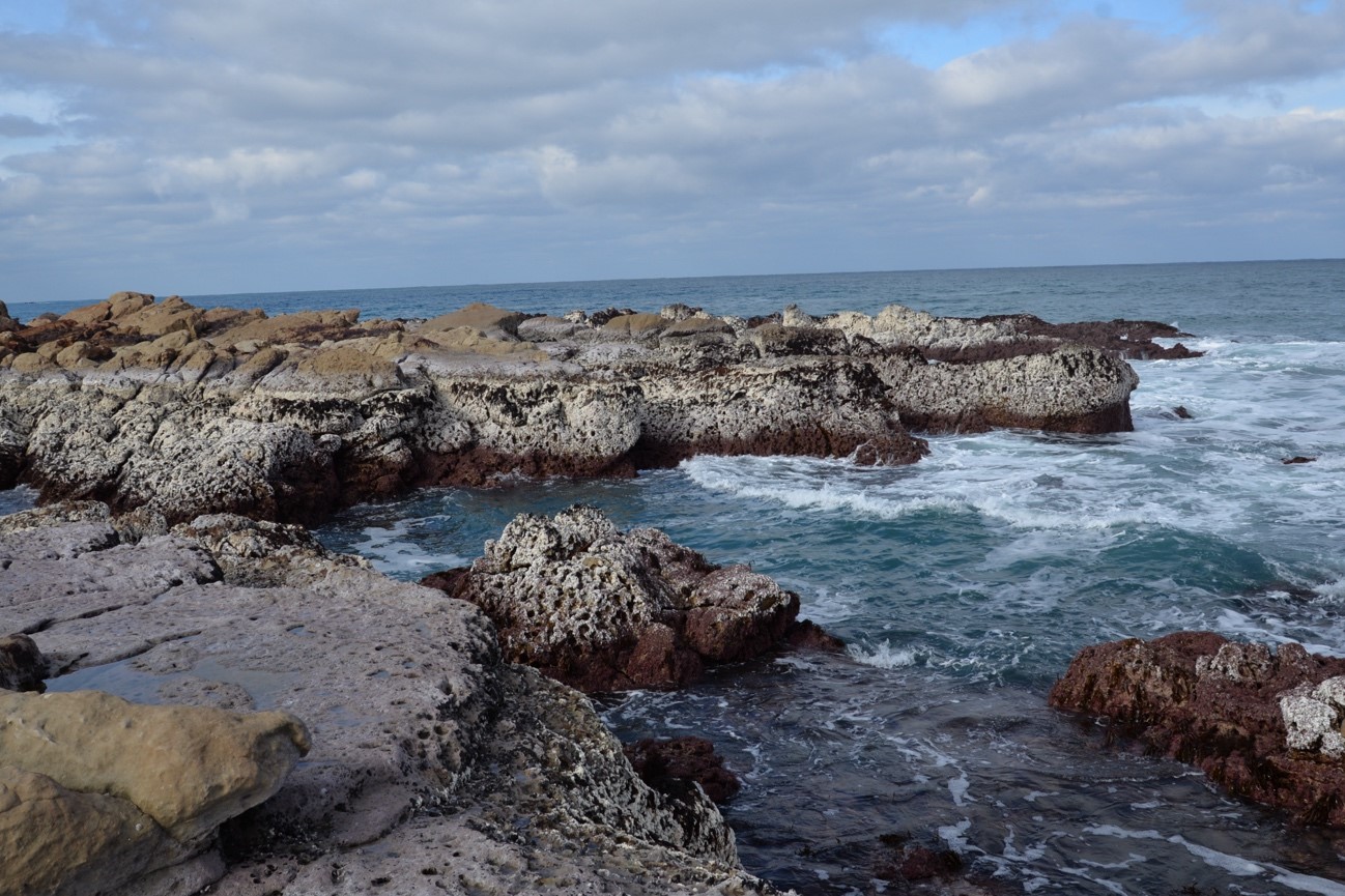
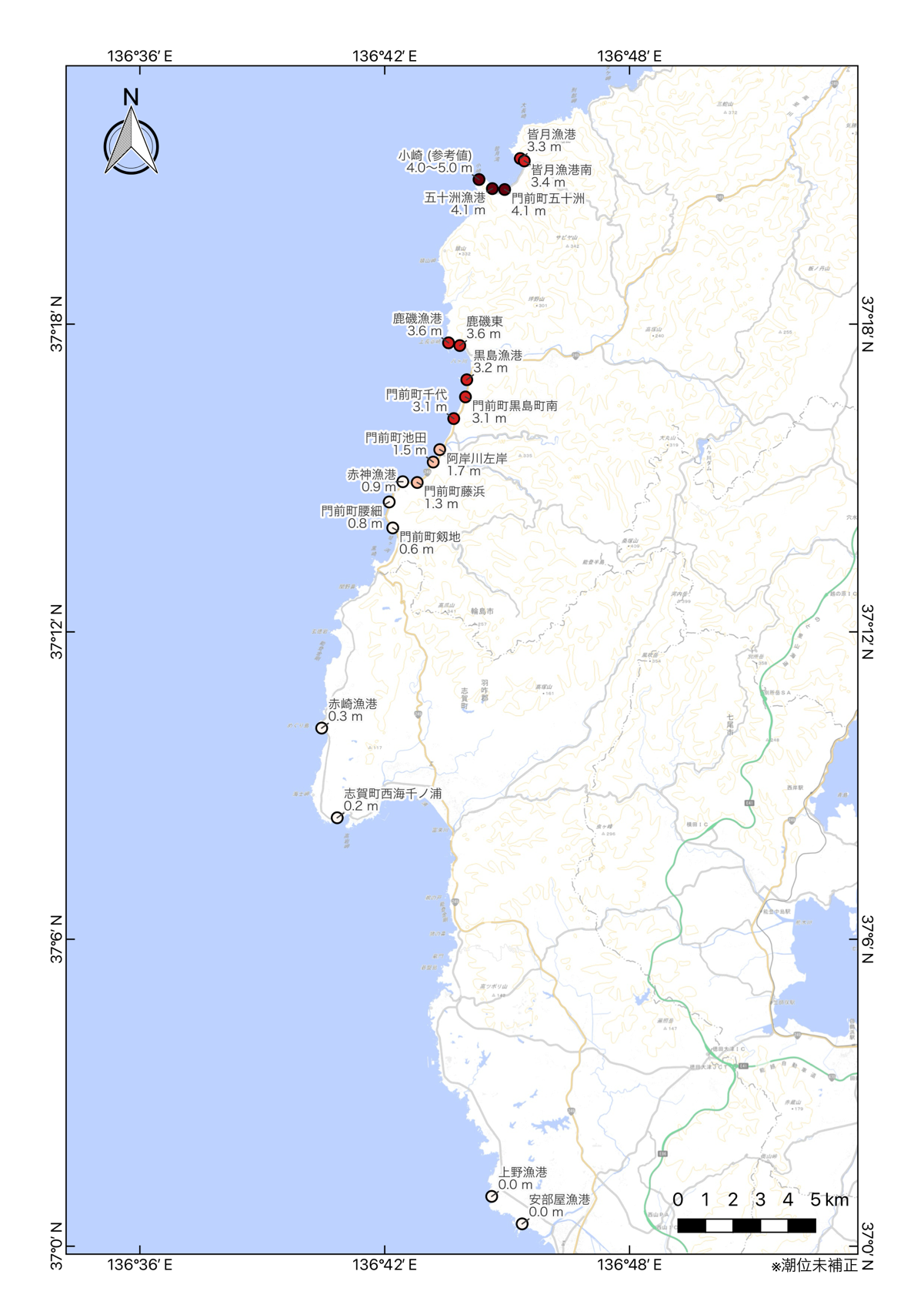
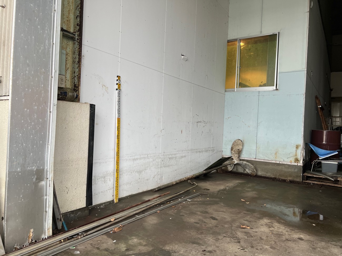
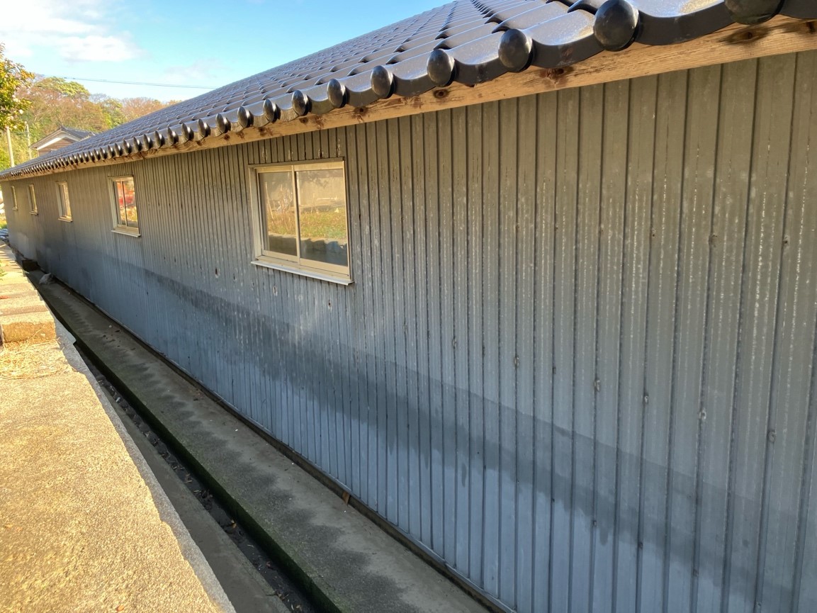
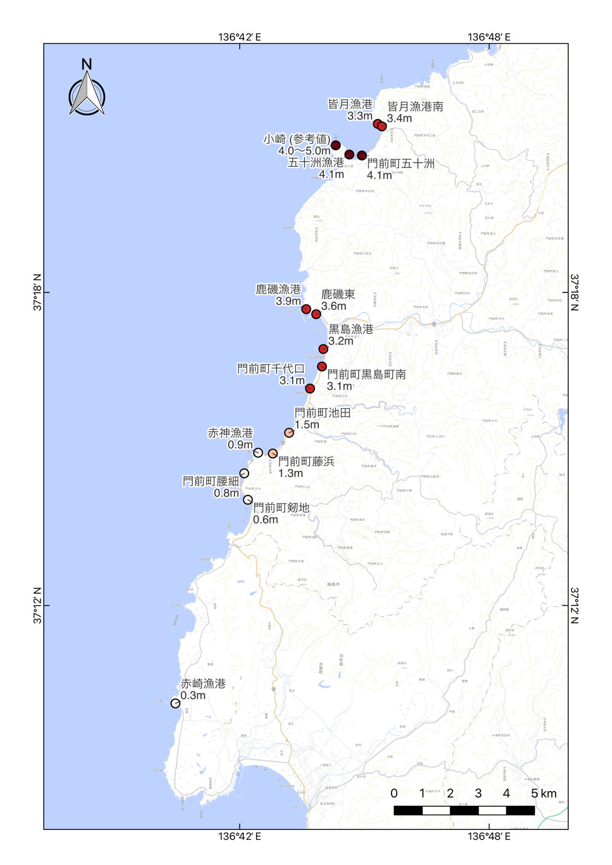
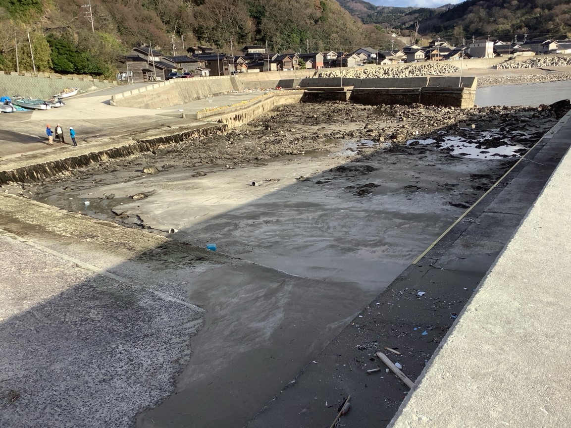
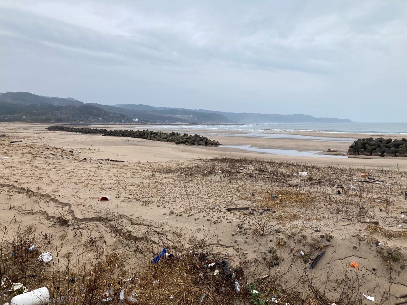
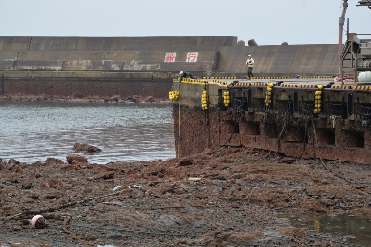
2024 年1月1日16時10分に、石川県能登地方の深さ約15 km でM7.6(暫定値)の地震が発生した。地震の発震機構は北西-南東方向に圧力軸を持つ逆断層型で、上部地殻内で発生した地震である(地震本部, 2024)。この地震によって生じた地震性隆起の痕跡を調べる目的で、地震発生翌日の1月2日より能登半島北部の海岸地形調査を実施した。現地の道路・被災状況等を考慮し、能登半島北西部の調査を引き続き行った結果、石山ほか(2024)で報告した石川県輪島市門前町鹿磯(かいそ)から同志賀町赤崎に加えて、石川県輪島市門前町の皆月海岸においてこの地震によって生じたと考えられる顕著な海岸隆起および津波の痕跡を見出した(図1)。
このように、今回の地震に際しては、震源域南西部にあたる能登半島北西部の海岸に約4 m を超える顕著な海岸の地震時隆起が生じたと推定される。皆月海岸で認められた隆起量は、宍倉ほか(2020)で推定された地震前の完新世段丘面(L2面)の旧汀線高度と類似する値であり、能登半島北西部に分布する完新世段丘面群は今回のようなM7級地震の繰り返しによって形成された可能性がある。今回の地震・津波は、海陸境界断層の構造・分布・活動性の十分な理解が沿岸域の地震・津波ポテンシャルの推定と被害の軽減にとって本質的に重要であることを改めて示した。特に、今回の地震に伴う海岸隆起は、海陸境界断層の活動性を解明する上で海成段丘の離水時期や変形、形成プロセスの理解が重要な鍵となることを意味する。今後も現地の被害状況に十分配慮しつつ、引き続き調査を継続する予定である。
令和6年能登半島地震(M7.6)で生じた海岸隆起【速報】 Coseismic coastal uplift associated with 2024 Noto Peninsula Earthquake (Preliminary Report)
石山達也(東京大学地震研究所)・松多信尚(岡山大学)・立石 良(富山大学)・安江健一(富山大学) Tatsuya Ishiyama (Earthquake Research Institute, the University of Tokyo), Nobuhisa Matta (Okayama University), Ryo Tateishi (University of Toyama), Ken-ichi Yasue (University of Toyama)
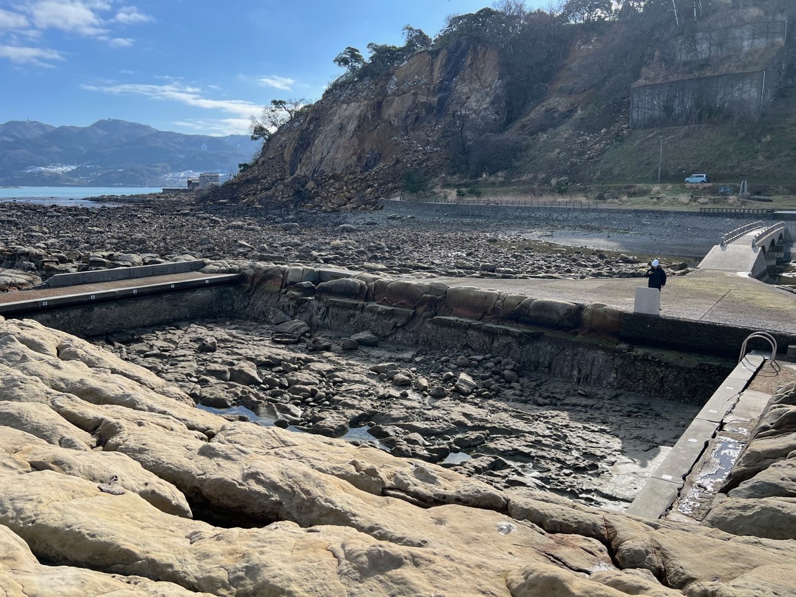
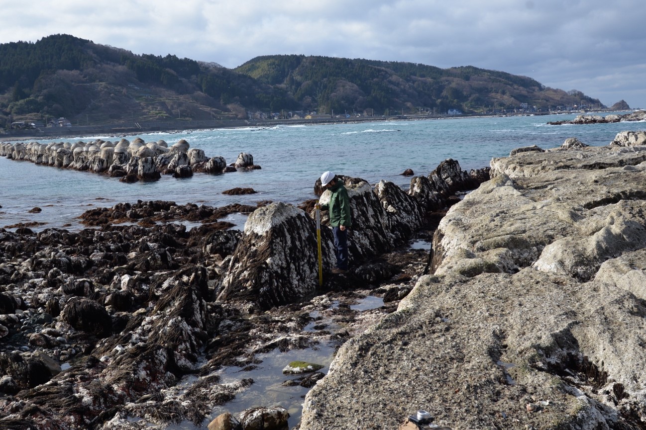
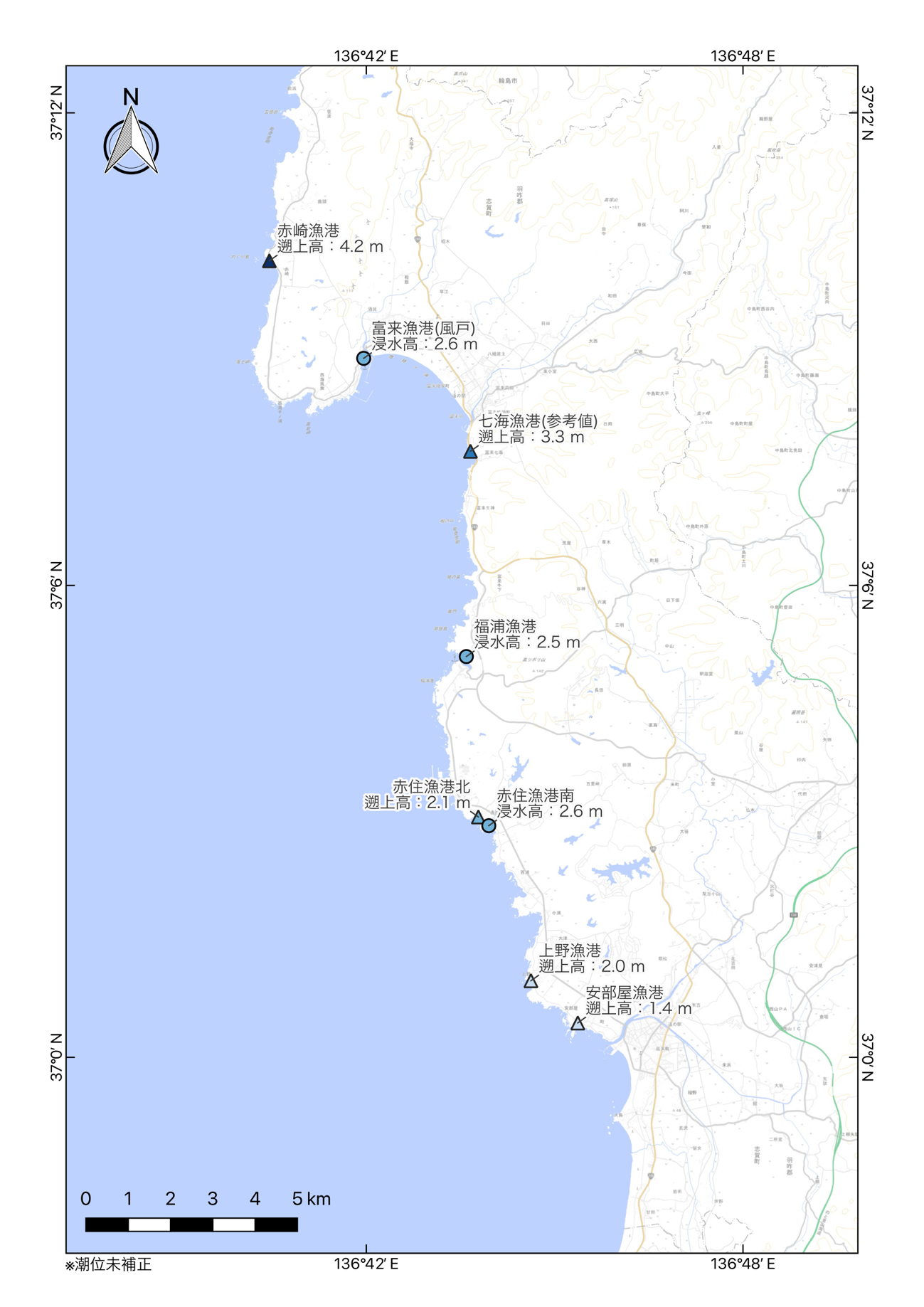
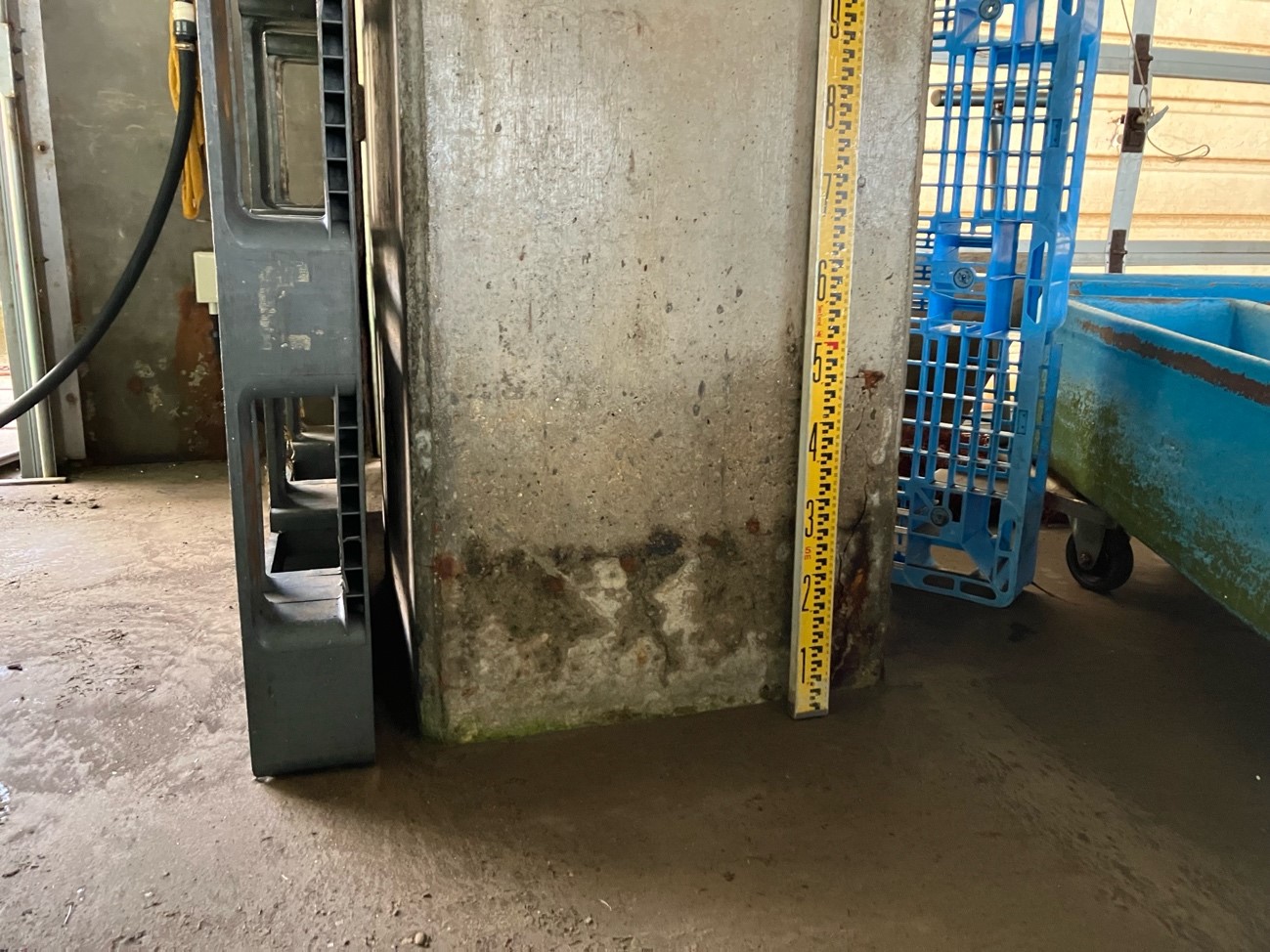
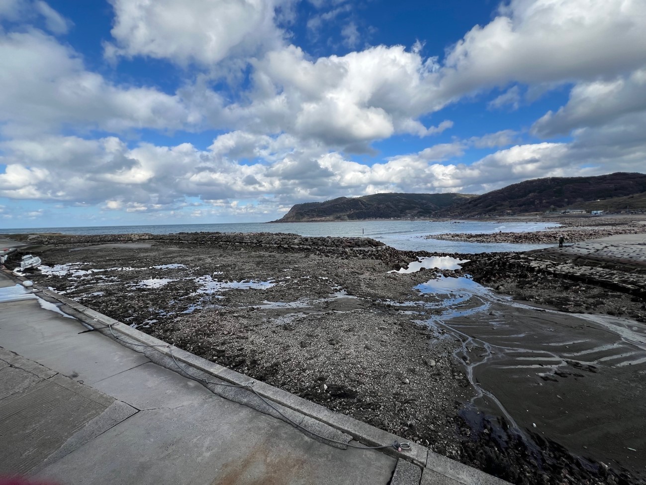
2024 年1月1日16時10分に、石川県能登地方の深さ約15 km でM7.6(暫定値)の地震が発生した。地震の発震機構は北西-南東方向に圧力軸を持つ逆断層型で、上部地殻内で発生した地震である(地震本部, 2024)。この地震によって生じた地震性隆起の痕跡を調べる目的で、地震発生翌日の1月2日より能登半島北部の海岸地形調査を実施した。現地の道路・被災状況等を考慮し、能登半島北西部の調査を行った結果、石川県輪島市門前町鹿磯から同志賀町赤崎にかけての複数地点において、この地震によって生じたと考えられる顕著な海岸隆起および津波の痕跡を見出した(図1)。
このように、今回の地震に際しては、震源域南西部にあたる能登半島北西部の海岸に少なくとも約4 m の顕著な海岸の地震時隆起が生じたと考えられる。また、海岸隆起が小さい箇所では津波被害が確認された。今回の震源域直上にあたる能登半島北岸では複数段の完新世海成段丘面や離水生物遺骸群集が断続的に分布し、調査地域のさらに北方ではその分布高度が高いことが知られている(宍倉ほか, 2020)。現地の被害状況に十分配慮しつつ、今後も引き続き調査を継続する予定である。


_v2.jpg)
_v2.jpg)
_v2.jpg)
_v2.jpg)
_v2.jpg)
_v2.jpg)
_v2.jpg)
_v2.jpg)